Excavation Reports
2012 Report
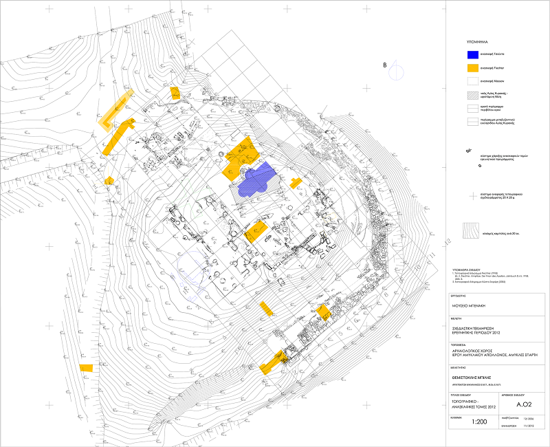
29-06-2012 13:53During the year 2012, in accordance with decision no. ΥΠΠΟΤ/ΓΔΑΠΚ/ΑΡΧ/Α2/Φ42/54670/675/15.6.2012 of the Ministry of Culture, the following works were carried out in the Spartan sanctuary of Apollo Amyklaios:
B) Excavations
1. The excavations of 2011 continued investigations in grid-square Κ6, revealing part of the foundation of an apse that abuts the north wall of the church of Saint Kyriaki. The surface on which the apse is founded was located and the stratigraphy of the surrounding area was studied. This apse is constructed of rude stones with lime plaster and gravel as mortar. It can be attributed to the triconch building excavated by Ch. Tsountas in 1890 and destroyed in 1907 by the works of E. Fiechter, and later by the building of the new church. From its shape, dimensions and masonry, it can be correlated with the apse that survives approx. 20 m. south, in symmetrical corresponding position, touching the preserved part of the crepis of the Throne. In the southeast corner of the same grid square, the excavation reached down to the poros bedrock on which it is bedded, and in the southwest part to the solid surface of fine pebbles on the bedrock. Removal of the fill so as to reveal the natural surface in its entirety has not been completed. Nonetheless, in the excavated area a clear prehistoric level was found, from which a large quantity of pottery of the Early Helladic II period was recovered. 2. In order to explore systematically the natural surface of the hill, to unite the already excavated parts of the area in which the Throne is placed, and to locate cuttings in the bedrock to receive the foundations of this monument, the excavation was extended into grid squares Θ4-Κ4. The stratigraphy turned out to have been badly disturbed by the earlier trenches opened by Tsountas in 1890 and Fiechter in 1907. The volume of earth removed, 0.30 m. to 1.80 m. thick, belonged to a level of later fill with many recent objects. Among these were three coins, one Venetian of the 18th century and two Greek of the 19th and the 20th century respectively, nails, fragments of roof tiles and lime plaster, pottery of various periods, from the Geometric to the Byzantine, and several miniature aryballoi. Under the recent level extends the familiar solid layer of pebbles. As in the area of the Throne, it was ascertained that this layer represents the upper level of the natural surface of the hill. Along the length of the central N-S axis of grid squares Θ-Κ4, an oblong ditch 1.00-2.00 m. wide and 0.40-0.60 m. thick was found, perhaps relating to the history of the Throne. This is the northward continuation of the ditch that had been uncovered in 2011 in grid squares Ζ-Η4 and to the south meets the massive limestone blocks set at right angle. The removal of the contemporary fill revealed large architectural members, most probably from the Throne, one conglomerate block of the under-foundation, two marble blocks and one marble beam, which had been discarded there after the breaking up of the monuments in the sanctuary. The fill, mainly in grid squares Ι-Κ4, also yielded several other marble fragments, parts of the marble revetment (dado), of an antae capital and of a trapeza, as well as large sherds of a pithos. Along the length of the ditch, three of the familiar circular pits were identified, empty and relatively shallow, similar to those found at other points in previous years. These too have been opened in the natural solid layer of fine pebbles on the hill, one near the south limit of grid square Θ4, the other on the south limit of grid square Ι4, the third at the south limit of grid square Κ4. A short distance from the west edge of this last square, a well of diameter approx. 1.00 m. was found. The contemporary fill was removed to a depth of 1.85 m., yielding a large quantity of domestic pottery, mainly Byzantine, as well as one rectangular bronze sheet of the Geometric or the Archaic period. In the north part of grid square Ι4 and at a depth of approx. 1.30-1.80 m. below the present surface of the hill, beneath the solid layer of fine pebbles is the yellow porous bedrock. The later cutting of it to form a longitudinal trench, transverse to the central ditch running through grid squares Ζ-Κ 4, is clear. The contemporary fill and the pockets of yellowish clayey soil were removed, but were devoid of finds. The opening of the trench should be associated with the excavations conducted here by E. Buschor in 1927 (Buschor E., Massow W. von, Vom Amyklaion, AM 52, 1927, 25-26, fig. 12). At the east edge of grid square Κ4 a fourth circular pit was revealed, of diameter 1.25 m. and depth 0.58 m., with sterile yellow clayey soil. Last, at the west edge of the same grid square, upon the natural conglomerate layer of the hill, the east part of an oblong grave, destroyed and disturbed, 0.86 m. long and 0.58 m. deep, with walls of small rude stones, was brought to light. 3. With the aim of exploring the area of the Altar, excavations that had begun from grid square Z2 in 2011 were resumed. In grid square Ε4, with the blocks originating from the pedestal of the cult effigy (xoanon) in second use, the level of the contemporary fill, 0.40 m. thick, was removed, without characteristic finds. In grid square Ζ2 removal of the contemporary fill was completed, revealing over its entire surface the natural solid layer of pebbles. A large quantity of pottery was found, which is dated from Geometric into Byzantine times. Noteworthy among the numerically greater finds of Geometric painted pottery is an amphora fragment with representation of two nude male figures facing right and holding sword and spears. Interesting too are a sherd of the same period with depiction of a male figure, possibly in a representation of dance, several almost intact Geometric cups, many miniature aryballoi, bronze sheets and fragments of bronze objects, as well as two fragments of lead votive offerings in the shape of a wreath. On the natural conglomerate surface of the ground, two more circular pits were found, empty and relatively shallow. Last, worthy of mention are the sporadic traces of burning. 4. In order to reveal the structure of the monumental precinct-retaining wall to the north, so as to resolve open issues relating to dating, and to locate the continuation of the earlier corresponding wall of rude stones, the excavation was expanded eastwards into grid squares Θ-Ι 9-10, Κ10, Λ8-10, Μ8-9 and Ν7-8. Along the west part of grid squares Θ-Κ 10 and Θ-Ι 9, after removing the contemporary fill of thickness 0.10 m. to 1.00 m., the manmade surface of porous stone was revealed over an area of maximum width 3.00 m. Here too the stepped formation of the natural ground is analogous to that on the east and south sides of the hill, verified in the excavations of 2010. This year’s excavation data demonstrate beyond doubt that these interventions are related directly to the successive building of the two periboloi. In grid squares Θ9 and Ι9 it was ascertained specifically that the horizontal cutting of the rock shaped the upper level. Thus was formed the bedding for the foundation of one wall, length 5.60 m. and width 1.80-2.20 m., of medium-size rude and roughly-worked limestone stones, with earth as mortar. This wall follows the lie of the land along the N-S axis and curves sharply eastwards in grid square Θ10. From the position, the structure and the relation of its construction to corresponding remains on the south side of the hill, it is certain that this is part of the Geometric retaining-cum-precinct wall, and indeed its north, probably reinforced, end. Its building is possibly related to the ditch, 1.60 m. wide and 0.30 m. deep, along the length of grid square I9, which was formed by cutting away the rock on the upper level. Exactly the same formation had been uncovered in 2010, in the excavations conducted along the length of grid squares Γ-Δ 9 and Ε-Ζ 10. Yellowish grey clayey soil was removed from inside the ditch. The large quantity of mainly LH II pottery recovered from this fill indicates that it belongs to a purely prehistoric level. Bedded on the second terrace, which is to the east and lower than the aforementioned one, with the almost vertical and then horizontal cutting of the bedrock, are the conglomerate blocks of the foundation of the monumental precinct-cum-retaining wall. Removal of the fill, varying in depth from 0.40 m. to 1.10 m., from grid squares Θ-Λ 10 revealed the internal structure of the foundation, of maximum width approx. 1.80 m., between the outer course of blocks of the under-foundation and the bank of the artificially formed surface of the bedrock. This is a construction of large and medium-size conglomerate and schist stones, more commonly limestone, rude and roughly worked. Their systematic placement along the length of the east limit or diagonal to this in grid squares Ι-Κ10, presents a more irregular arrangement to the west. The stratigraphy of the fill in the grid squares in this area is badly disturbed. This is due on the one hand to ancient and recent interventions, and to slippages of material from the upper surface of the hill after the collapse of the peribolos, and on the other to the levering of the soil by the roots of trees that existed there. In grid squares Θ-Κ 10, in the space around the part of the Geometric peribolos uncovered, the fill contained pockets of soft brownish yellow earth with a remarkably large quantity of prehistoric pottery, mainly of the EH II period. Noteworthy is the similarity of these finds to those recovered from the purely prehistoric level in grid squares Γ-Δ9 and Ε-Η10, during the 2010 excavations. The rest of the fill yielded pottery of various periods, from prehistoric to Byzantine, as well as a few contemporary artifacts. Outstanding are four fragments of clay zoomorphic figurines, the lower part of a Mycenaean figurine of Psi type, a sherd of an Archaic pithos with relief representation of a chariot, several sherds of Orientalizing Corinthian pottery of Archaic times, an intact ovoid ribbed aryballos, part of a terracotta probably architectural member with relief spirals and small crosses, as well as two fragments of obsidian. In order to reveal in full the external course of blocks, as well as the internal structure of the foundation of the monumental peribolos, the excavation was expanded into grid squares Λ-Μ 8-9 and Ν7-8. In this area the peribolos curves to the northwest, inside grid square Λ10. The fill, ranging in thickness from 0.25 m. to 1.70 m., yielded pottery of Geometric and prehistoric times, and a handle fragment of an Archaic pithos with relief decoration of meander pattern. Concurrently, certain rectangular conglomerate blocks of the outer side of the peribolos and a pile of medium-size rude stones on the inside were revealed. It is possible that this pile of stones is related to the ‘filling in’ of the inner side of the peribolos, given that after its removal the artificially cut, steeply sloping bedrock, as well as the rude stones placed systematically or irregularly along its length, from the internal structure of its foundation, were revealed. The pottery recovered is exclusively Late Mycenaean and Geometric, now a decisive datum for dating the monumental peribolos to Archaic times.
B) Mending, restoration and trial correlation of architectural members
This season’s works at the archaeological site included the mending of fragments of architectural members of the Throne. Carried out by the marble technician Dimitris Lambros, under the supervision of the architects Themistoklis Bilis and Maria Magnisali, aim of this measure is to restore the structural self-sufficiency of the monument’s components. The materials used were titanium coils of assorted cross-sections, white Portland-type cement and fine-grained quartz sand. Wherever deemed essential, plaster casts were taken, in order to complete the carving in new marble of the completions of missing parts.
The architects continued the trial placements of architectural members in certain ensembles of structural elements of the Throne, which could be used in the final presentation of the archaeological site for the at least indicative enhancement of the monument. From the processing and study of the material new data emerged, not only relating to the identification of dispersed architectural fragments, but also to the at least graphic restoration of the monument. For this purpose the following pieces were transferred from the storeroom of the V Ephorate of Prehistoric and Classical Antiquities: the shafts of columns inv. nos Λ410, Λ408, Λ402, Λ407, the capitals of the antae inv. nos Λ 428, Λ421, parts of entablatures inv. nos Λ400, Λ409, Μ10 (study cat. no.), of cornices inv. nos Λ415-6-7/ Λ385, Μ19-20 (study cat. no.) and of crownings inv. nos Λ379, Λ368, Λ275, and the sima inv. no. Λ411.
The excavation trenches, the architectural members, as well as all other finds resulting from this season’s investigations, have been drawn, photographed and digitized.
C) Other works. In the framework of studying the material gathered in the course of the research project, the electronic database was updated. It is planned to make the database available on the Internet, facilitating on-line access for all agents involved. For the fullest mapping of the archaeological site and the works carried out to date, aerial photographs were taken of Agia Kyriaki hill by the photographer Costas Xenikakis.
With the support